Download USGS aerial photos from Microsoft's Terraserver Web site.
USAPhotoMaps downloads USGS aerial photo and topo map data from Microsoft's free TerraServer Web site, saves it on your hard drive, and creates GPS-accurate maps from it.
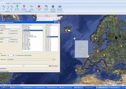
You can: Scroll and zoom, See latitude/longitude, USGS Landmarks, Tiger/Line streets, elevation and contour lines, Add waypoints, routes, and text, See photos associated with waypoints, Go to any address, populated place, USGS landmark, or ...
Redirecting to a secure site. We are checking If the link is working. Please wait...
You can report broken links into broken@dailydownloaded.com. Our editors will review them shortly.
Download and keep the maps updated all the time.
Download maps from Google Maps, Yahoo Maps, Bing Maps, or OpenStreet Maps.
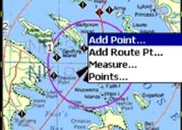
Plan routes and perform real-time GPS navigation on land, sea, and in the air.