Work with various maps and perform feathering, spectral analysis and contrast adjustment.
Global Mapper has built in functionality for distance and area calculations, raster blending, feathering, spectral analysis, contrast adjustment, elevation querying, line of sight calculations, cut-and-fill volume calculations, as well as advanced capabilities like image rectification, contour generation from surface data, view shed analysis (including Fresnel) from surface data, watershed delineation, terrain layer comparison (including differencing), and triangulation and gridding of ...
Redirecting to a secure site. We are checking If the link is working. Please wait...
You can report broken links into broken@dailydownloaded.com. Our editors will review them shortly.
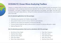
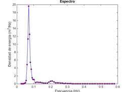
Analyze the wave data time series collected by sensors in open body of water using Matlab/Octave.
Perform a variety of matrix related calculations.
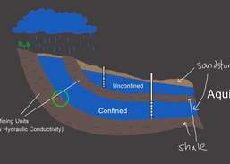
Evaluate unconfined compression tests.
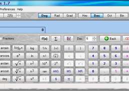
Perform algebraic, statistical, and other functions.