ESurvey CAD Specifications
|
Carry out a variety of civil survey engineering design tasks.

ESurvey CAD is a comprehensive software solution for Civil Survey Engineers for creating Contours Quickly, Section Generation for Volume Calculation, Earthwork Quantities (Quantity Takeoff) and Converting point data into Topographical map. Key Features:
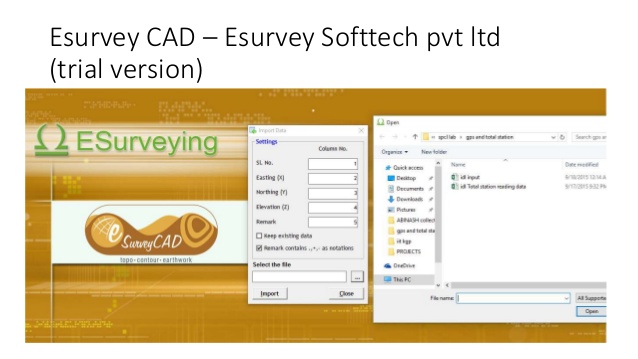
Topodraw:
Import point data from CSV or drawing Import blocks automatically while creating drawing Export codes, point data in different layer selectively Create Total station data from CAD drawing Selectively Auto Connect codes in CAD
Contours:
Import data from CSV, Excel or CAD for Contour generation Generate Contours directly within CAD Draw Section for any alignment fixed on the Contour Map Generate Contour Area and Contour Volume instantly - Boundary Based / Specific Levels Generate Grid Elevations (Block Levels)